Third Time Lucky!
⬅ previous ⬆intro next ➡28 December - Coyhaique to Puerto Guadal
Now our Patagonia road trip really begins.
We start by retracing some of our route from the airport, but about two-thirds of the way back, we turn off to continue on the Carretera Austral - the "Southern Highway". It must be said that this sounds quite a lot grander than the road appears to warrant, as it soon turns to gravel and hard-packed earth.
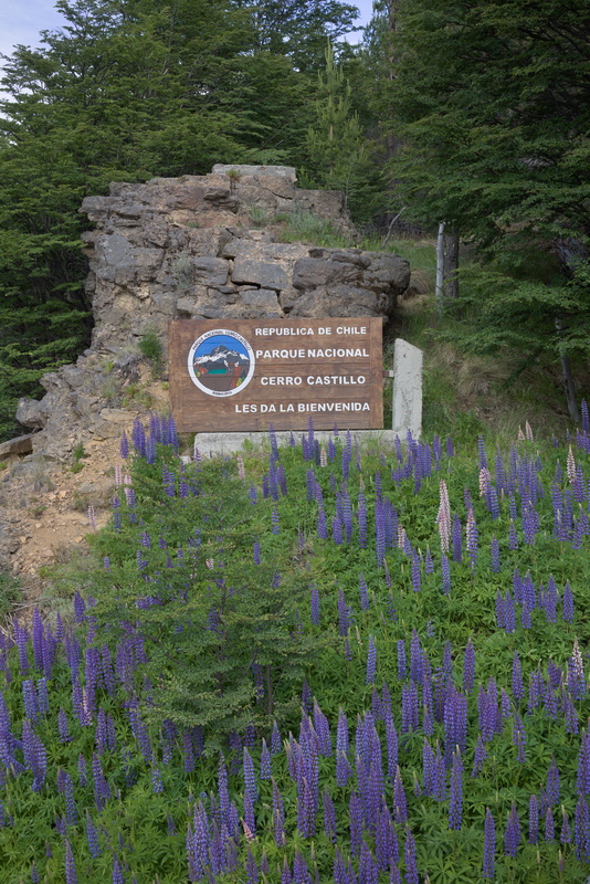
But we're entering the national park region now.
You'll notice the lupins. There are a lot of lupins in Patagonia!
[Hmm... so I go to Google to find out if the lupin is actually native to Chile, and the entire first page of results is about some French Netflix series. So's half the second page... A typical item starts, "If you are a person who watches Netflix, you have no doubt been greeted on arrival by a recommendation to watch “Lupin.” [...] with the streamer having announced an expected 70 million households had at least taken a peek within a month of its Jan. 8 debut, even more than “The Queen’s Gambit,” the chances are good you [are among them]". Oh dear, yet another 21st century cultural moment has passed me by.]
But back to flowers: Wikipedia says there are hundreds of species, widely distributed across the Americas, but there are some North African and Mediterranean natives too, never mind all the introduced and cultivated varieties. Seems they are not as simple as we naively thought: "The taxonomy of Lupinus has always been confusing. How many distinct species exist or how they might be organized within the genus is not clear."
And although Dennis Moore realised some things weren't so simple as he'd thought, he still completely missed the complexity of lupins!
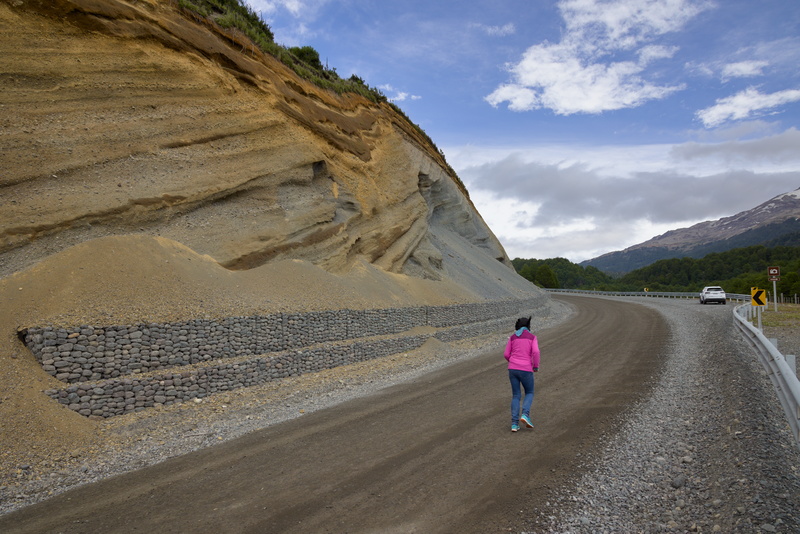
This is what the "Southern Highway" looks like here. We've stopped to admire the rock strata at a parking spot, but as you can see, the road isn't exactly busy.
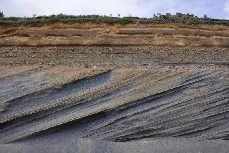
Is it geology or is it art?!
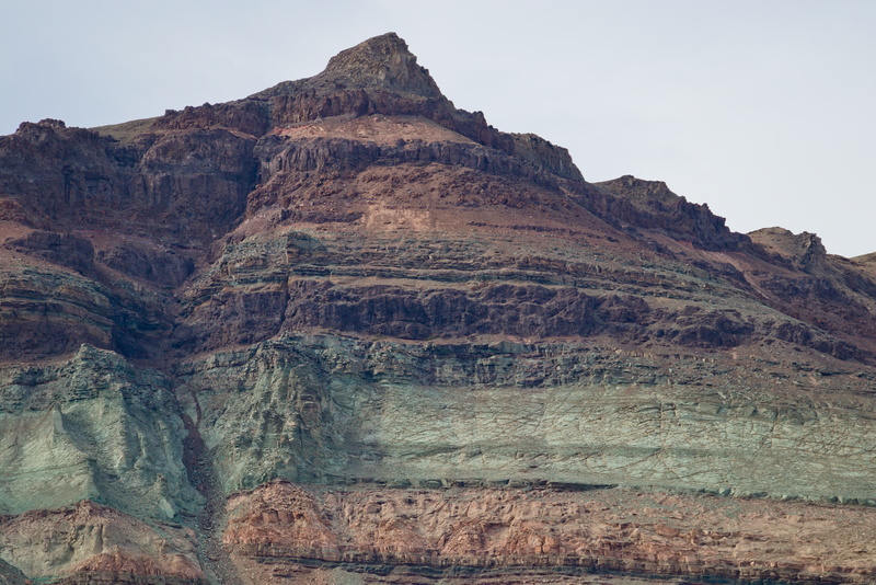
Chile is the world's largest producer of copper, and although most of the mining takes place in the north, the blue-green colour shows that there is plenty in the rocks here. Although mining remains the biggest single driver of the economy, tourism is steadily growing and there are large protected areas such as this. The geography probably makes industrial development quite hard too, so with a bit of luck, this environment will remain relatively pristine for the foreseeable future.
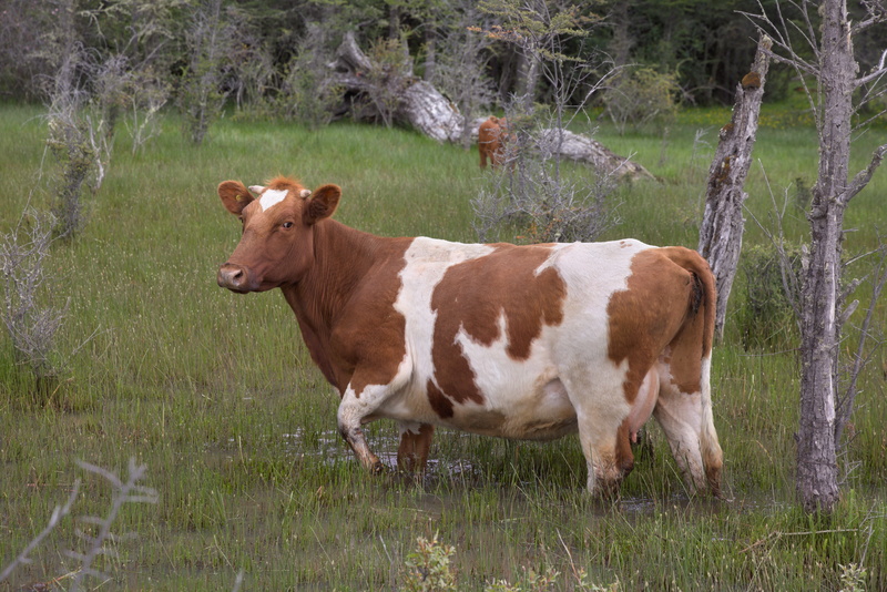
Cow in a swamp.
Although we've generally been lucky with weather, it can rain a lot here. Moreover, there are plenty of streams fed from springs and melting ice, so the ground can get extremely wet in places. This cow and her calf in the background seem completely unfazed.
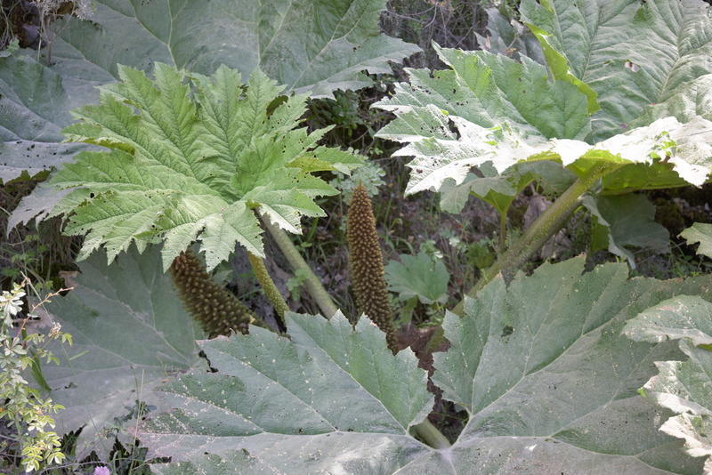
It's not just lupins that are big here, there's a lot of gunnera too. It's quite small by the standards we are used to, but otherwise we think nothing of it. But when we get home, we make a discovery! In the RHS Garden magazine for January, we read:
Plants grown as Gunnera manicata have long been considered the quintessence of hardy exotica. But DNA studies have now shown that their massive leaves hide a secret and previously unsuspected past.
It seems that the true G. manicata species is native to Brazil, but the plants known by that name in the UK are actually a cross with the Chilean species G. tinctoria. The hybridisation happened back in the 19th century without anybody realising until now.
Read all about it from the horse's mouth here at British and Irish Botany.
G. tinctoria, incidentally, is now classified as an invasive species and banned from sale in the UK.
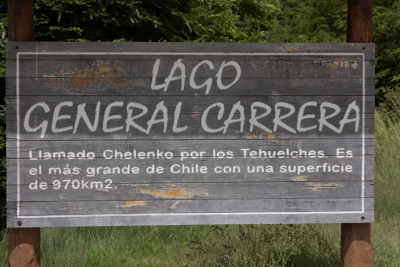
The place were're staying at is on the shore of "General Carrera Lake", the largest in Chile (and partly in Argentina too, but they call their bit "Lake Buenos Aires". The sign says the indigenous people called it "Chelenko" with obviously no concept of colonial-era boundaries).
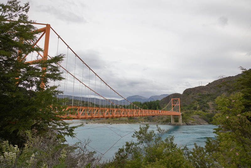
The general also gets a bridge named after him. Technically, this side of the bridge is Lake Bertrand and the general's own lake is only on the far side. It's the biggest bridge we'll be crossing, but I can't tell you more than that because there's almost nothing (in English at least) that Google knows about it. Wikipedia doesn't mention it at all, and virtually all of the search hits are for photo libraries like Getty and Alamy. So I, by taking this picture, and you, if you copy it, are literally taking the bread from corporate executives' children's mouths. Oh dear.
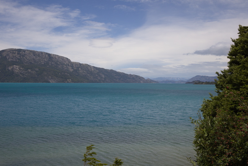
This is what the lake looks like from near the bridge. It stretches off into the horizon, though, and there probably isn't any non-aerial vantage point where one can see the true scale of the whole thing.
So to the first of our 'real Patagonia' lodgings, El Mirador de Guadal. Strictly speaking, we leave the Southern Highway to travel up the eastern shore of the lake a short way and past a small town. Despite satnav, we miss the lodge turning initially because it's so low-key!
Oh, let me digress for a moment about satnav in relatively remote parts of the world like this. In general, there are three parts to navigation: knowing where you are; knowing where you're going; and knowing what's in between. The 'satellite' part of satnav is the first of those. Almost anywhere on the planet, if you have a reasonably clear view of the sky, the satellite signals won't be blocked and you'll be able to receive the GPS data that tells you where you are. But now you need a map. The satellites don't give you a map, you have to provide that yourself. Back home, you kind of assume without thinking that you will have wifi and/or cellphone signal, and your Google Maps app or equivalent will be able to get whatever data it needs whenever it needs it, which specifically includes the aforementioned maps. A few years ago, Google Maps started offering the option to save the map now in case you didn't have signal later, but if you don't explicitly do that, or you use a navigational app that doesn't have the feature anyway, you will be completely stuffed without phone signal. Which you won't have in the middle of nowhere. Which is where you need it most.
Let me show you what happened to us a few years back when I forgot to download a map in advance...
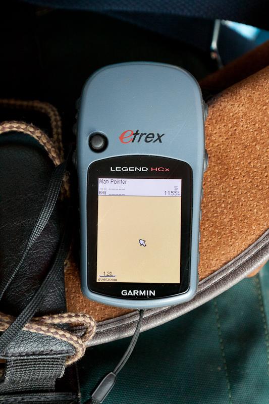
Basically, my GPS knows exactly where I am, it just doesn't have the foggiest notion where where I am is.
So make sure you use a navigation app that doesn't let you forget to preload all the maps that you will need, ideally before you even leave home. Not that I can speak for every one, but we used OsmAnd and I would happily recommend them. OSM (OpenStreetMap) is something we should all be supporting anyway.
Err, right, end of yet another digression.
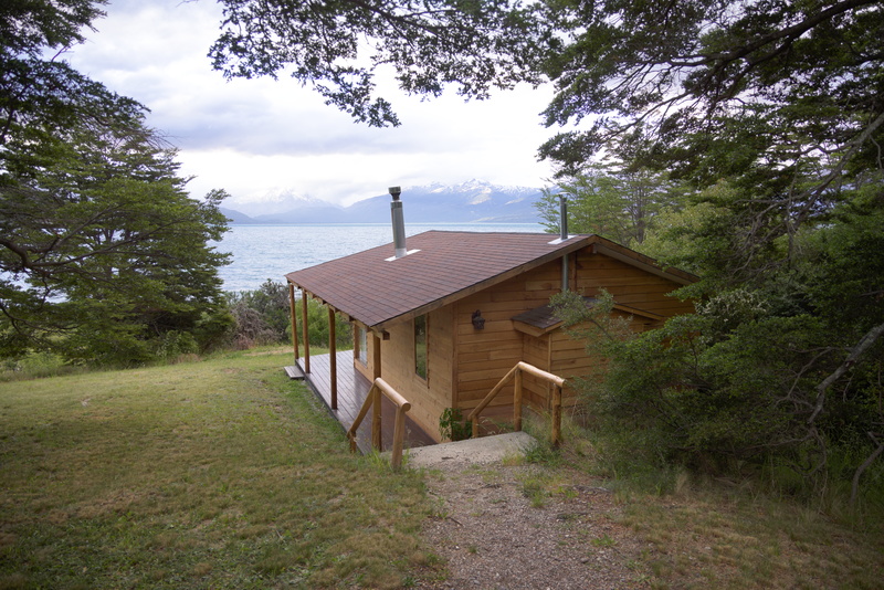
Here we are. The lodge is a classic case of "we liked the place so much we bought it" and Stefan and Carolina, the owners, have done a fine job. This is our little cabin, and although it's a little bit of a walk from the main building where breakfast/dinner/admin happen, we can park quite close. Well, Tiggo can park quite close: we wouldn't want to have to drive our own car down the rather challenging track!
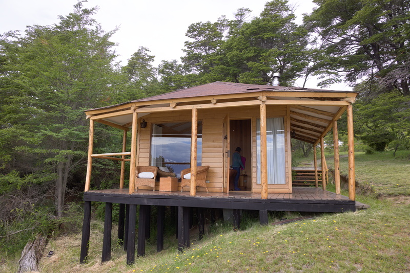
Here's the front view.
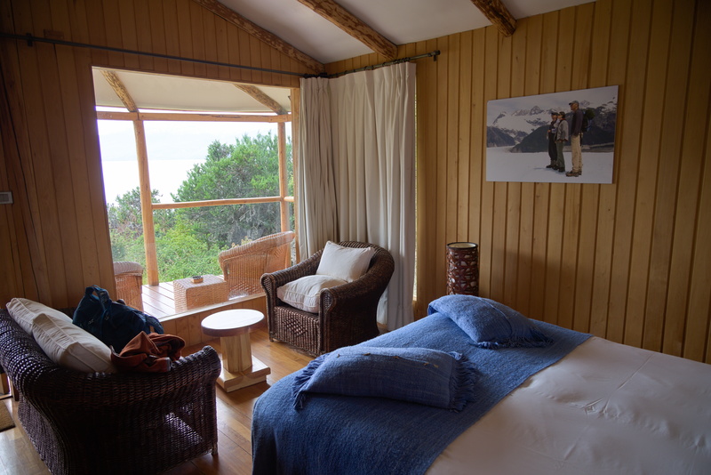
Simple but comfortable inside. We have a wood-burning stove just out of shot to the left, which will be nice on a cold night.
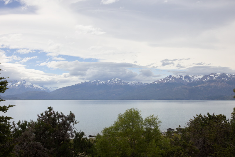
Again, a pretty impressive view from the room!
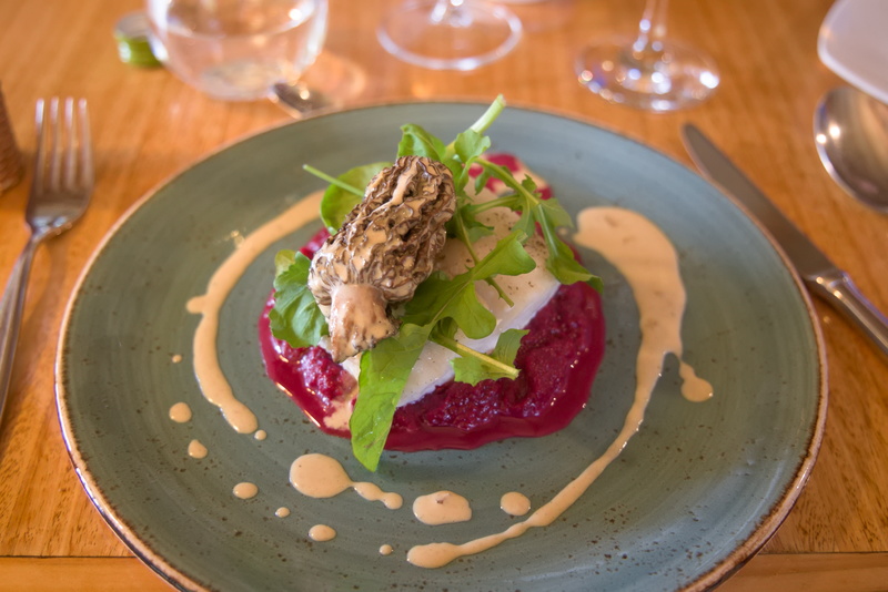
Dinner is excellent. Morel mushroom, fish fillet, beetroot purée with rocket and cream sauce (I think).
According to our understanding of the package, we should have had some tours included, but when we chat about our options for tomorrow with Stefan, it seems we're pretty much on our own. In all honesty, that's not a big deal for us, as being herded in a group is rarely our first choice, and we don't mind paying for private tours, or going totally DIY even though it means we might miss some stuff that a guide would show us.
Anyway, we want very much to see the famous marble caves, and Stefan says that we can go into the tourist town, Puerto Río Tranquilo, or we can check out his mate whose place is a bit before there and much closer to the caves themselves. The price is $90,000 (ie, near-as-dammit £90) per boat, so it'll be that divided by however many people are there, potentially just the two of us, but that's fine. Sounds like we have a plan.
⬅ previous ⬆intro next ➡