Third Time Lucky!
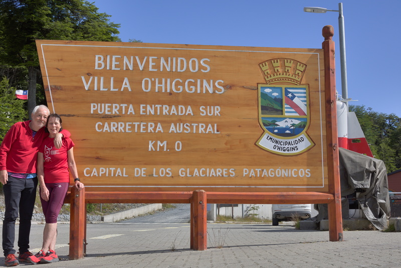
⬅ previous ⬆intro next ➡4 January - Villa O'Higgins
Amanda fancies a bit of a run today, and we think we ought to see the true end of the road which is a few km further on. Sounds like a plan!
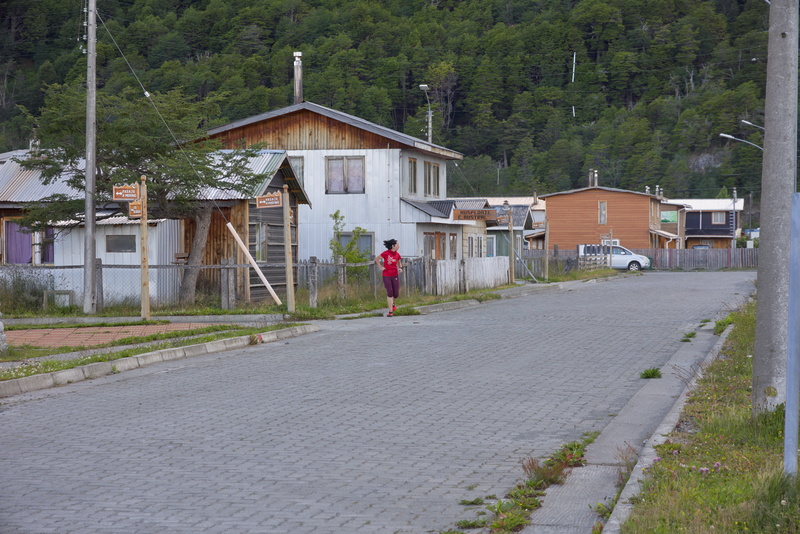
There's some confusion at first. I won't say Amanda gets lost... Perhaps better to say that for a period of time she's 'differently routed'.
We find ourselves and the right road in the end, though.
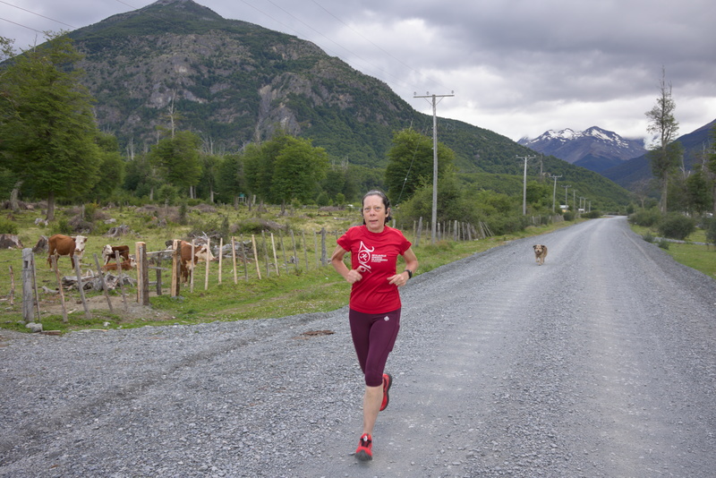
Note the dog running behind her. We're now at least a couple of km out of town and this dog has been following her all the way.
It's a very friendly dog - there's no sense that it's in any way vicious or threatening - but Amanda is worried that it's a long way from home and might be lost. Nonsense, I tell her, but she's not convinced.
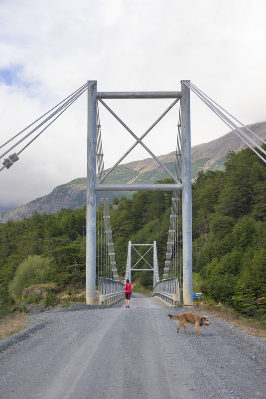
We reach a bridge and doggie says, "That's it for me" and turns around. Amanda's fears are (shock horror!) not realised.
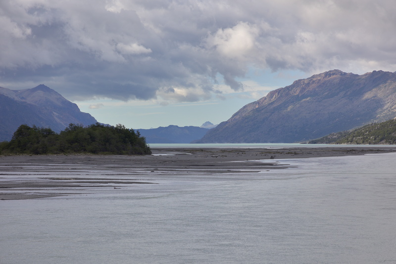
I continue on ahead until I find another place to pull in, and while I'm wating for Amanda, I'll take some scenery pictures, I think that we'd probably be able to see our destination from here if it was a straight line, but it's not.
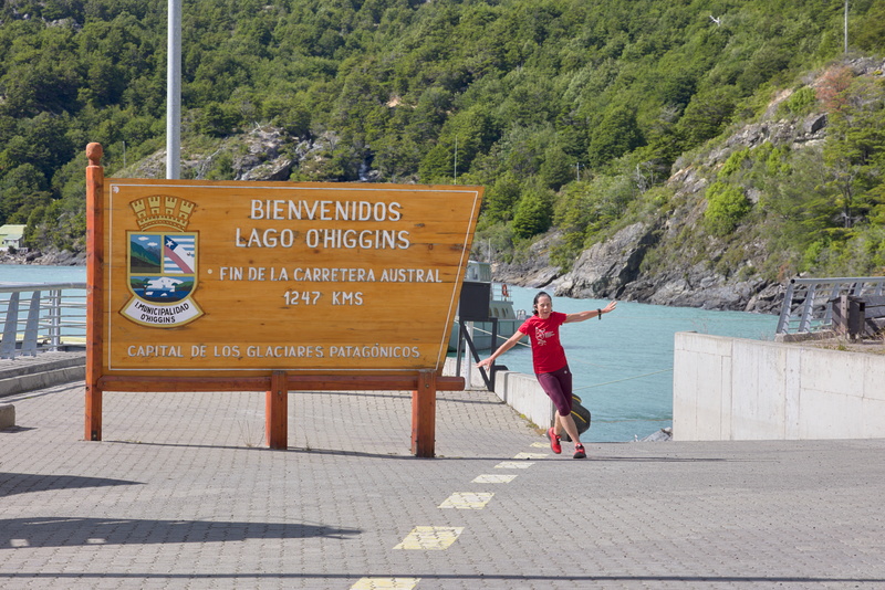
And here we are: the end of the road!
And also, of course, the beginning in the other direction.
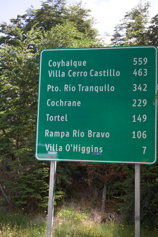
This is our entire route in reverse. We're not quite sure why the sign only lists places up to Coyhaique, as that's less than half the total length of the Carretera, but it's perfect for us.
We drive back to Villa O'Higgins to have a look around.
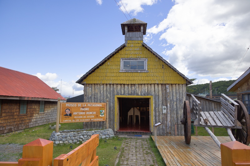
There's a small museum dedicated to Father Antonio Ronchi.
Who's Father Antonio Ronchi? Well, a little research (here for example) will tell us that, "Father Antonio Ronchi arrived in Chile in 1960, at the age of 30, and dedicated the remainder of his life to work within her most rural and isolated communities. [...] [His] works are so numerous that you could stop in almost any town or village in the region and ask for recommendations".
So what's in his museum?
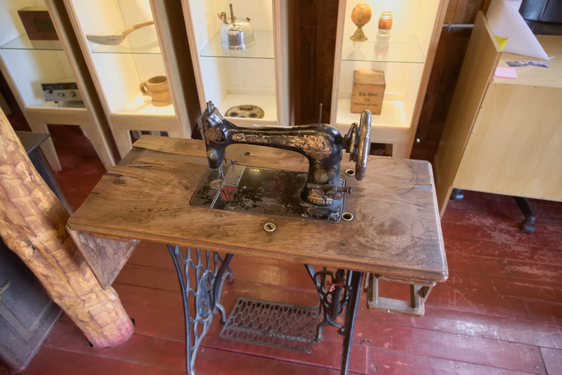
Several sewing machines, amongst other things!
As we're pondering the deeper meanings of it all and about to leave, a woman comes in and strikes up a conversation with us. Well, I say 'conversation', but it's not really much more than, "Where are you from?", "The UK"; and suchlike. And I say 'us', but as is usually the case, Amanda has made a run for it while I do the talking-to-strange-people bit. Turns out she's from the tourist information office, just across the road, so in most parts of the world you'd expect her to have more than half a dozen words of English! Anyway, I sign the visitors' book as she asks and she seems happy.
Amanda takes advantage of me being accosted to go and have a look at the tourist office without risking being accosted herself. However, she can't get close before being blasted by loud music that is very much not to her taste, and it doesn't seem like there's anything in English that can easily be seen, so she makes her escape.
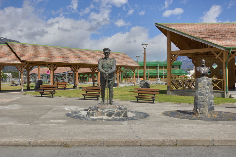
The town square is a curious mish-mash of design, but they do like their military statues. The little pink spot in the background on the left is Amanda standing on a bridge that seems to go from one side of a bit of grass to the other.
Now perhaps at this point I ought to acknowledge the fact that "O'Higgins" doesn't sound a very Spanish name. The town is named for a hero of the Chilean war of independence, Bernado O'Higgins. Wikipedia tells us that "O'Higgins (Irish: Ó hUiginn) is an Irish noble family" and Bernado was the illegitimate son of an Irishman who travelled to Spain, then to Chile where he ultimately worked his way up to Governor and then to colonial Viceroy of Peru, which at that time included Chile. It's kind of ironic that his son was one of the leaders of the struggle to be free of Spain.
Wikipedia also tells us that the Spanish pronunciation of his name is [beɾˈnaɾðo oˈ(x)iɣins] but we seem ok with the English version.
I don't want to think how illegal this would probably be in the UK, channelling the spirit of Boudicca like that!
After lunch, we think we are going to climb the hill above town.
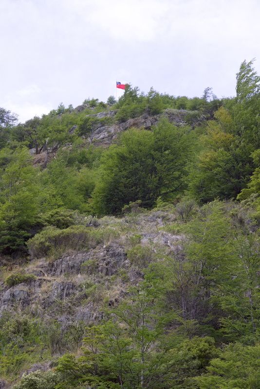
We've seen this flag from ground level, and according to our digital OSM map, there's a footpath to it. As elsewhere, we've found nothing remotely like a local tourist map which would have such things on it, so a certain leap of faith is required. OSM data is mainly provided by enthusiastic amateurs, so you can't always be too certain of its reliability, but it does seem to be by far the best available here.
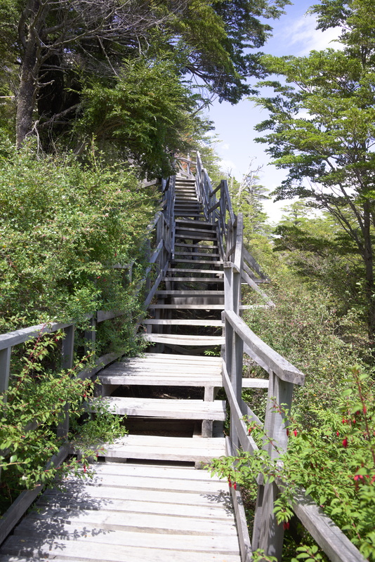
And indeed, there may be no tourist information about it - certainly none in English and nothing immediately obvious in Spanish - but it looks pretty real!
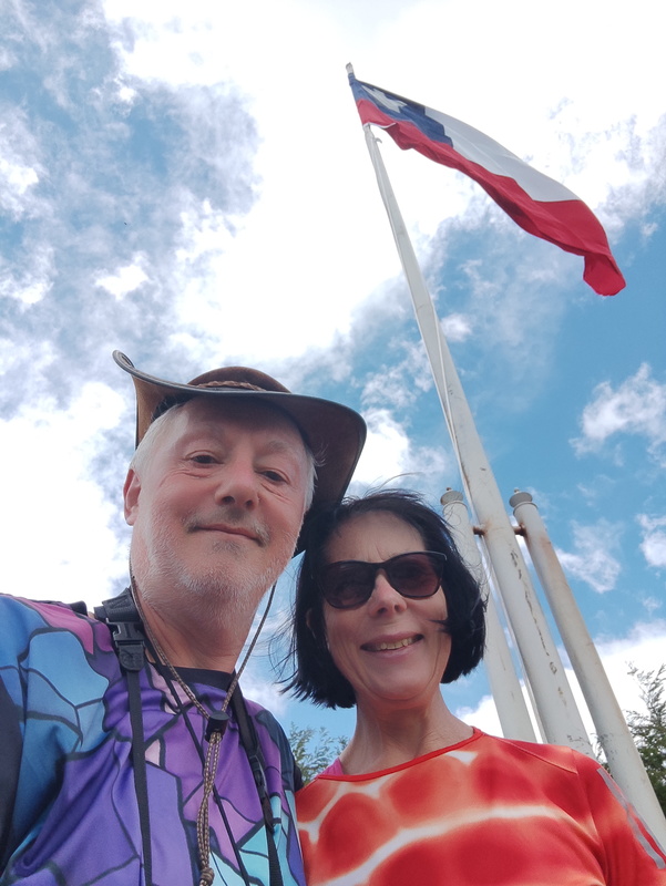
It turns out to be a tough old climb - those fancy steps don't last long at all! - but we are here.
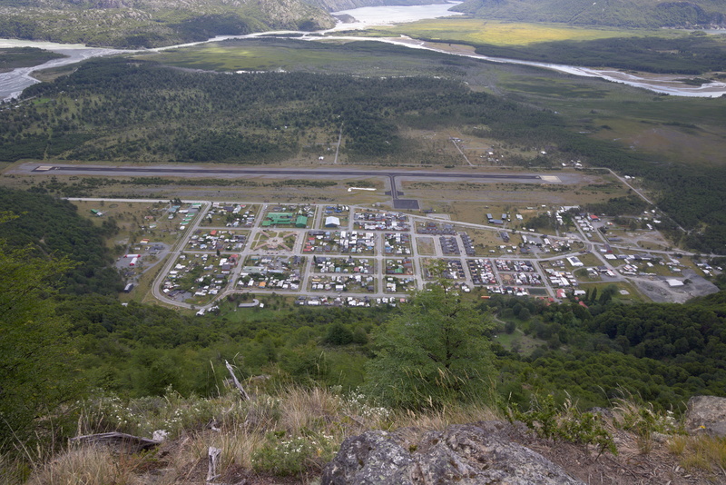
And there's the town down there. Hard to see at this scale, but toward the bottom right there are some brown spots and one of them is our cabin roof.
As in many places we've been, they have an airstrip but it doesn't seem to get much use.
And now what has gone up must come down.
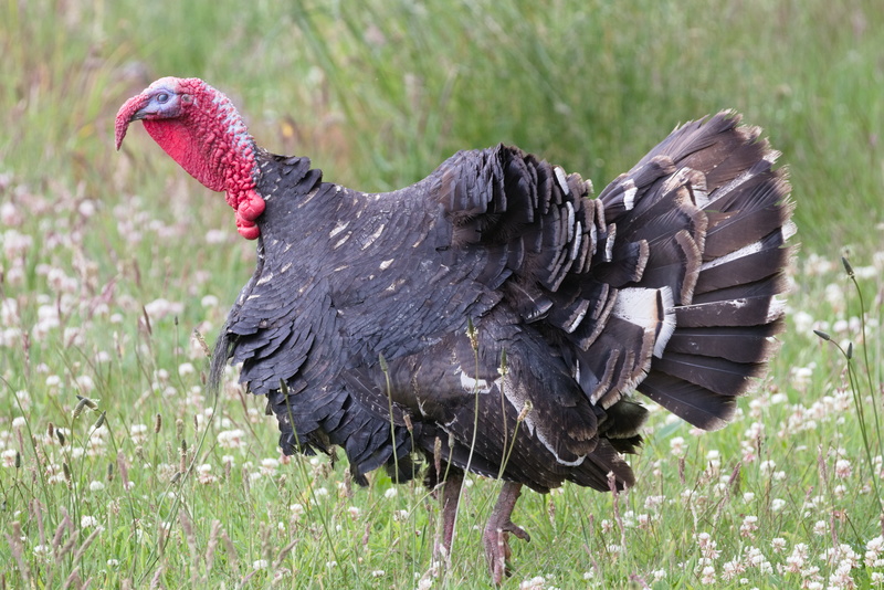
At the bottom of the hill is something which isn't quite a farm, more like a big garden with turkeys and chickens in it.
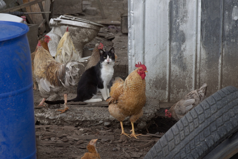
The cat and the chickens don't seem to have any problem getting on with each other. We're sure Oberon and Titania wouldn't be so casual.
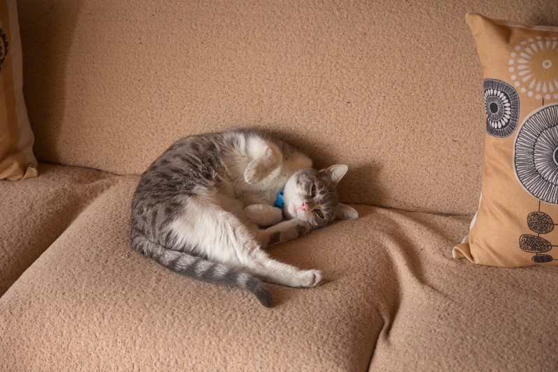
And talking of cats, we have a visitor! This very friendly puss comes in and says that we can stroke it and it will purr for us, so how's that for a bargain?
But as we've lit the fire and it's starting to get chilly, we want to shut our door. When we do that, puss decides that it's time to go. He or she is happy to visit, but isn't up for a sleepover.
So back to the kitchen for me: some dinner and a glass or three of wine and it's bedtime. Tomorrow we head back North again.
⬅ previous ⬆intro next ➡