The Rain in Spain!
⬅ previous ⬆intro next ➡Day 2 (May 9) ~ Olot to Sant Miquel de Pineda
We have quite a long first ride, 100km-ish, and it's going to be a bit hilly, so we're going to take it at a fairly modest pace and see how it all goes. First, though, we will go into the centre of Olot and have a look around, and pick up some provisions for lunch. We've been told that finding cafes can be a bit hit and miss sometimes in the more rural areas, but that's no big deal.
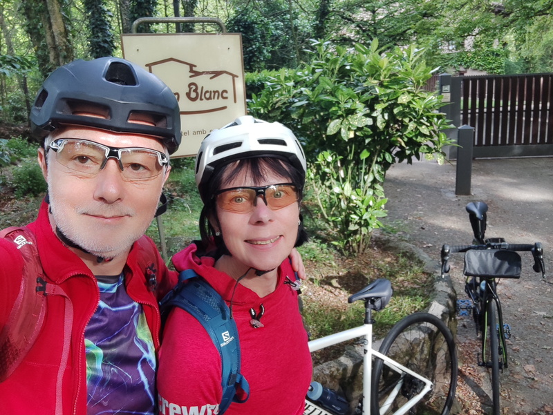
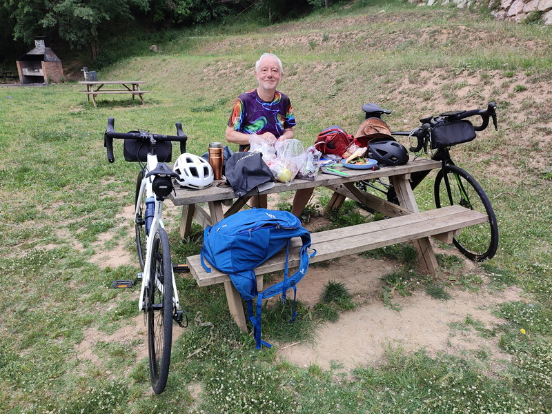
Ready to hit the road!
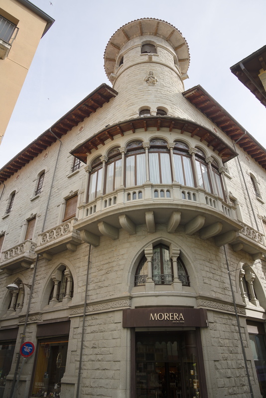
Olot is mostly a fairly nondescript town, but its centre has some interesting bits of architecture.
Ok, time to fire up the app...
We've been told that it mostly operates by voice instruction, so you don't need to be constantly looking at the map, but something seems to be wrong. The first instruction is "Turn left in 11.2km" without a hint of what to do until then! Turning on the map, the route is quite clear, and it's most definitely not just a long road from A to B. There are many turns and junctions which it will show us but not tell us.
If you do miss a turn, it goes "BONG!" at you in no uncertain terms, so it's not that it doesn't know the route, it's as if it thinks that somehow it's all just a single road regardless of how it twists and turns. I'm concerned, though, that if we do have to keep waking the screen up to see what to do, we're going to use much more battery than otherwise, so I break out my trusty Garmin as backup. Although we don't have the routes loaded into it, I do have detailed maps of the area and worst-case we can always just get it to tell us the shortest way to our destination from wherever we might be. And I know that it will run for a solid couple of days without any problem.
It does get better, though. It's still a touch gnomic in its proclamations at times, but we don't have quite the same level of confusion.
We pass throught the town of Tortellà, which wouldn't be worth a special mention, but...
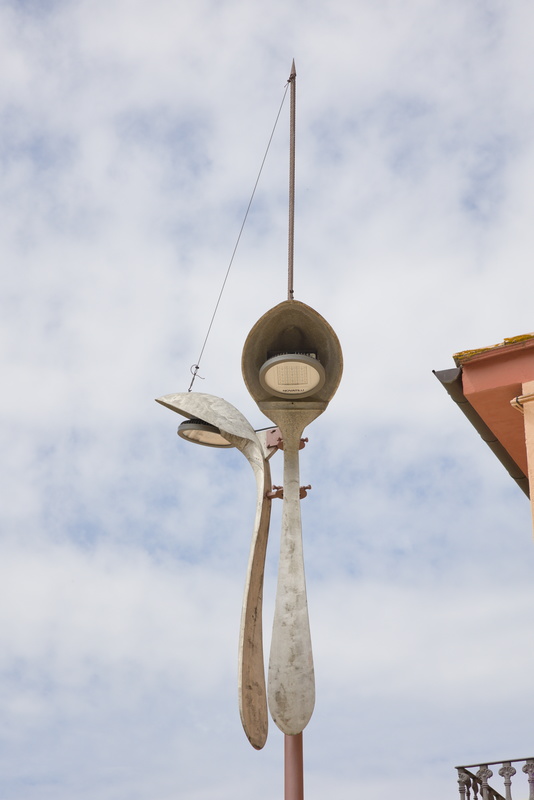
These rather fabulous spoon streetlights definitely catch our eye!
But not too long after, we have another problem with our navigation. "Turn right", our digital floozie commands, but it's just a road to a car park, so I think at first it's just another example of her slightly, err, different approach to the traditional concepts of left and right. But no, "BONG!", she meant it.
Ok, must be a cycle path beyond the car park.
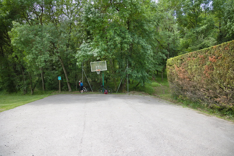
Well it should be here...
We look around, we can't see anything remotely resembling a cycle path. There's a somewhat rough-looking walkable track, but I follow it for a short while and it quickly becomes clear that it's not the same direction that the map claims it should be. The RideWithGps app seems to be based on the OpenStreetMap database, because that's what I've got on my Garmin too, and they are both quite unequivocal in their insistence that this road continues straight on here.
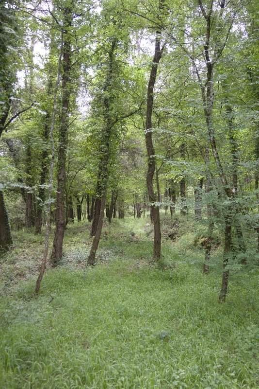
This, as best I can tell, is the exact course of the mythical road.
[I will later cross-check with Google Maps, and there's no such imaginary road there. However, in pretty much every other comparison I've ever made between the two, OSM is far better than Google at knowing about tracks and paths unsuitable for motor vehicles. On any other occasion, it would have been entirely reasonable for Google to say 'dead end' and OSM to offer a more nuanced view.]
So it's not a big deal: we can backtrack a bit, then take a real road that the fantasy trail would eventually join anyway.
As we near the point that the map claims we would have emerged, we look to see if there's any sign of even the faintest trail, but while I'm not going to rule out the possibility that a top-notch forensic team could find such a thing, we mere mortals see nothing whatsoever.
Let me show you a bit of our GPS track on the OSM map:
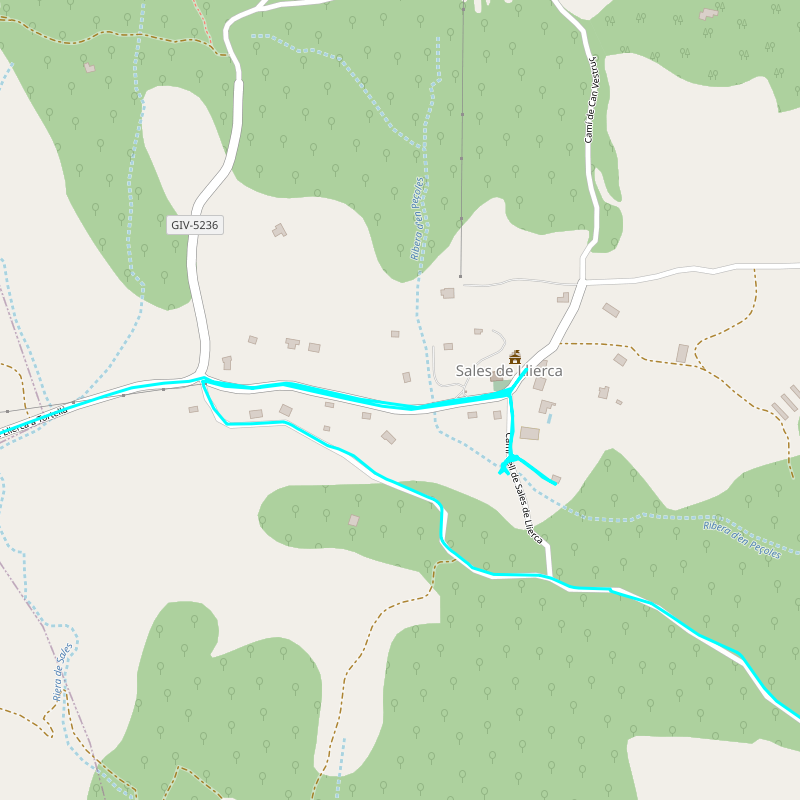
We cycled from the left, passed the right turn at Sales de Llerca, then went back and hit the dead end. We checked out the car park and the goat track that went in the wrong direction, then retraced our route back to the previous junction and continued down to where the nonexistent road was supposed to meet the real one.
Now before anyone assumes I'm totally slagging off this app, it should be said that our pre-app cycling holidays have rarely been wholly free of navigational challenges. This is no worse than some, and the techology giveth as well as taketh away because it's easy to get back on track once we realise what's happened.
[As I'm writing this, the news is full of 'experts' telling us that Artificial Intelligence is an existential threat to the human race (mainly, I think, because ChatGPT can do a convincing Donald Trump impression). On this showing, our future AI overlords won't even be able to find us in order to oppress us!]
But after this, it's all fairly straightforward to the town of Besalù.
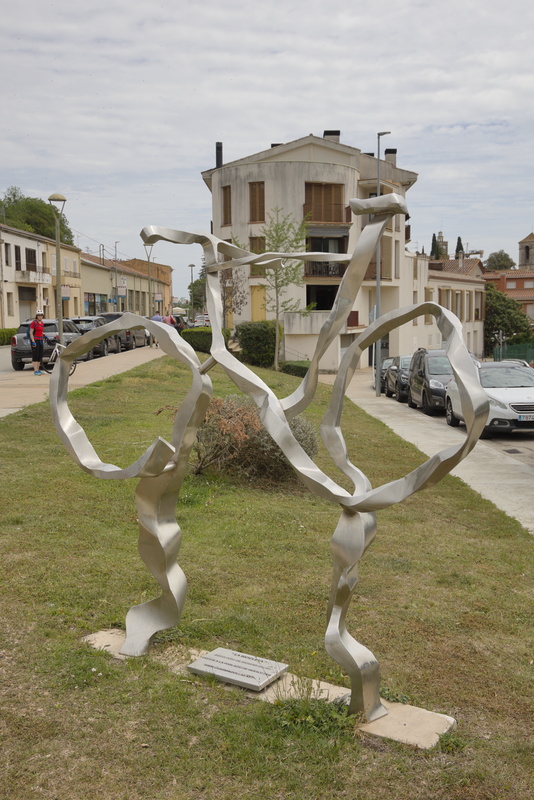
The edge of town is marked by a bicycle sculpture!
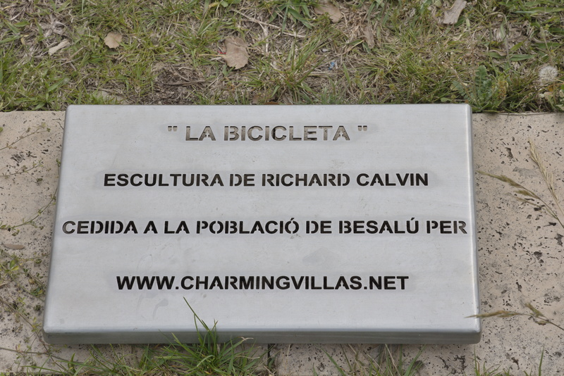
You can probably figure that out even without being a native speaker! www.charmingvillas.net is exactly what you almost certainly think it is: a local company offering holiday homes to tourists.
Hmm... If you go to their website, then the home page is in English. Fair enough, it's mainly aimed at foreigners, perhaps. But there's a little row of flags to change language: in order, they go Català, Français, Deutsch, Русский and finally Español. Yes, the majority language of their own country comes last. I think we can figure out where they stand on Catalan independence.
But I digress again.
As is not uncommon, Besalù comprises a fairly boring modern sprawl around a mediaeval core. Just before we reach that core, we find a nice picnic place to have lunch.
A table we can spread out on. I'm not entirely sure how two people's lunch can need quite so much space.
We study our navigational app and reckon we're about 2/3 of the way and making decent time. Sadly, this will turn out to be a completely false statement, but we don't know that yet.
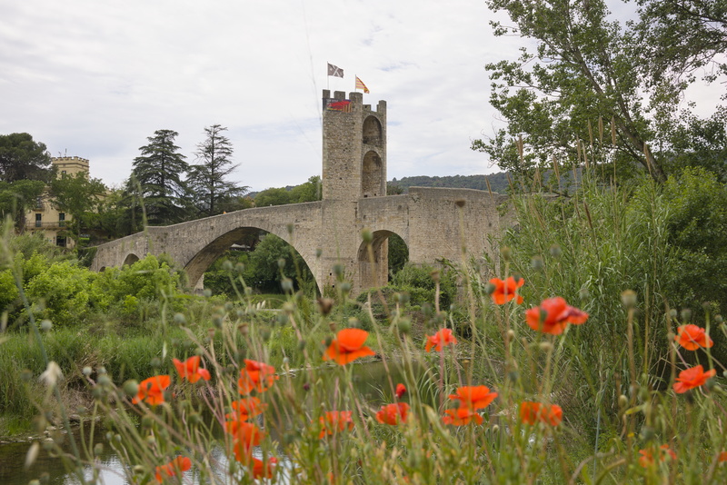
From near our picnic spot, a good view of the bridge that leads into the old town.
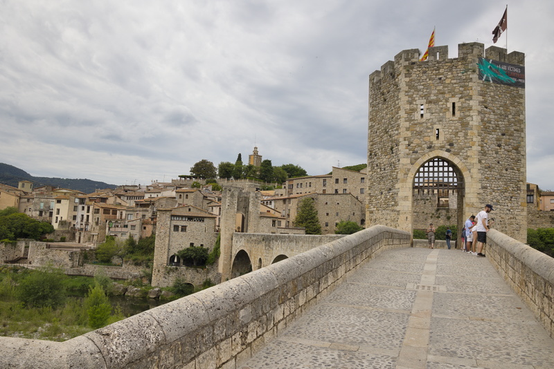
We take a walk to the outskirts but don't go further than the bridge. It's obvious this is a serious tourist attraction, with coach parties and everything.
I overhear a small child excitedly crying "Sea snake!" as he looks into the river.
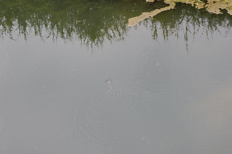
I think technically it's an eel, but it's still pretty cool, so I tell him that. Then his father tells me that they saw a beaver just a little further along. At least, I think that's what he said. I get the impression that the parents are first-generation immigrants to the UK, so Dad's English isn't great compared to the kid's. But if I did understand correctly, any beavers have got bored posing for tourists and buggered off already. Huh.
If we didn't have a fairly long day, I think we'd've explored a bit more, but we have miles to rack up still, even allowing for our over-optimistic misunderstanding.
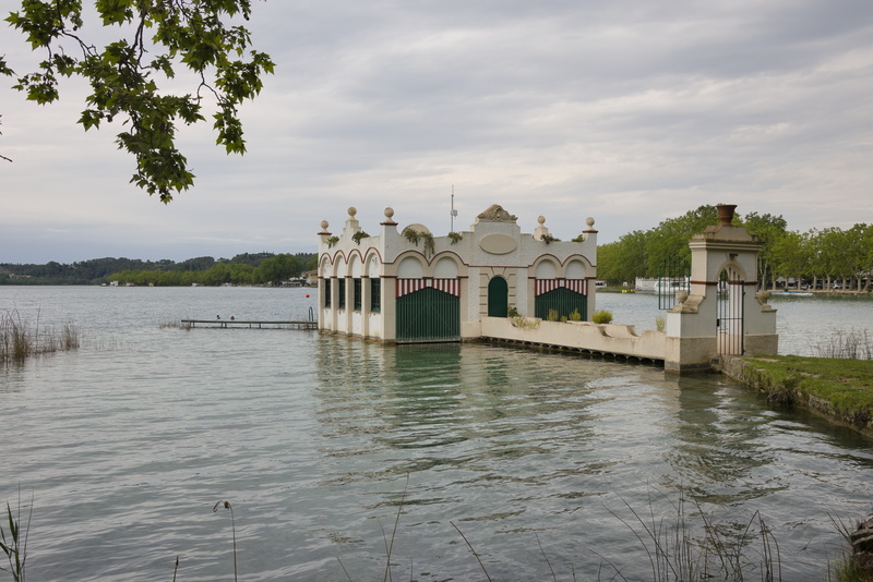
The next place of any note is the lakeside town of Banyoles. Once again, there's not a lot... but what there is makes you stop and stare for a moment. This is a boathouse that seems almost to be channeling the Brighton Paviiion.
Now we're going to have a big photo gap. As you may have noticed in the photos, the weather is pretty overcast, but just threatening without carrying out its threats. It starts getting a bit windy and drizzly and we're wondering why we don't seem as close to our destination as we thought.
The weather gets worse, and we realise that we - well, I - had misread the "distance done" field for "distance to go". Yes, my own fault, but I still think the app default is the wrong way round.
We reach a point where we're on a main (but very quiet) road and the app tells us to leave it and head off into the hills. We're now getting a bit cold and wet, and there's little point in taking the scenic route when you can't see the scenery, so we decide to cut our losses and I ask my GPS for the shortest route to Sant Miquel. Almost bugger-all difference as it happens - we're in the mountains and the roads go where the mountains aren't - but we reckon the major road will probably be a bit quicker, so we depart from the app route and follow our new guiding star.
The rain gets heavier, the wind gets stronger; and obviously, the wind isn't behind us.
Amanda's phone rings. Not a huge surprise, it's Mark. The hotel have been expecting us by now and want to check everything's ok. I tell him that we're cold and wet and running late... but otherwise fine. We're only a few km away now, so we should be ok without needing a rescue mission.
And the drowned rats finally arrive.
La Rectoria is owned by Roy and Goretti, who met in Scotland when he was a chef and she was whatever the whisky equivalent of a sommelier is. Quite frankly, in the state we are now, "we are not axe-murdering serial killers" would be enough as a welcome, but they are absolutely lovely and pretty much the second thing they say is, "Put your sopping wet clothes in this tub and we'll wash and dry them for you!"
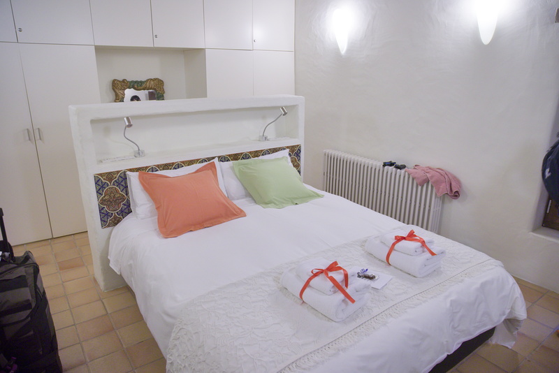
Again, simple, but comfortable and clean.
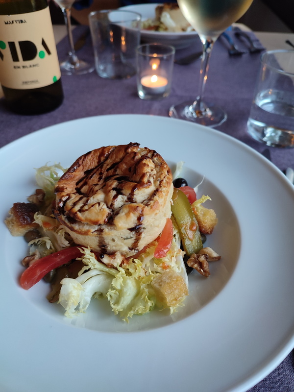
So I said Roy had been a chef, remember? Well it seems a fairly safe bet he didn't end up here because he was sacked for not being able to cook!
A little soufflé on some salady veg, and damned yummy it is too.
I suppose I should mention that there's nothing as poncy as a 'menu' here. They check that you don't have any special dietary requirements, but basically Roy cooks something and you eat it. In the admittedly unlikely event I ever found myself working in the restaurant business, I think I'd be the same, so that's fine by me.
So there we are: a good shower, good food, good wine, with friendly hosts in convivial surroundings. I'm not saying we've forgotten the gale force winds and the driving rain, but somehow it's all fading into the past...
Oh, and then they tell us that Mark and Shelley have said they'll pay for a bottle of wine for us by way of apology for the awful journey! Well that is just above and beyond: it's hardly their fault that the weather was bad. Isn't everyone lovely!
⬅ previous ⬆intro next ➡